
Church Street / Church Walk, Gateshead
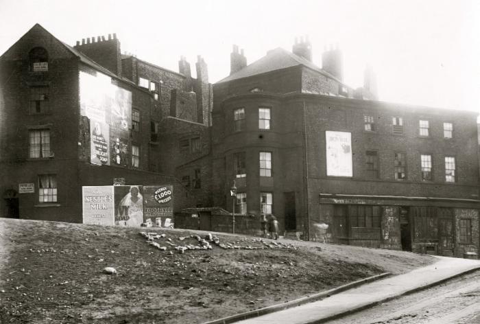
Title: 2-10 Church Street, Gateshead, c.1932
Photographer: Unknown
Date: C.1932
Reference Number: GL002832
Large street adverts
Church Street was completed in 1790 in order
to accommodate traffic traveling to and from the recently built Tyne
Bridge. Church Street ran off Bridge Street in an arc past St. Mary's
Churchyard and led back onto Bottle Bank. It was not named until 1826
and for many years was simply referred to as 'the New Street'. (Manders,
1973).
Church Walk was situated to the north of St. Mary's Church on the steep bank leading to the River Tyne. Under the Housing Act of 1930, the Council was given much greater legal power to deal with slum housing. The worst housing was around the High Street and Quayside areas of the town. Four and five storey tenements in the Pipewellgate and Hillgate areas housed muiltiple families and huddled narrowed courts provided accomodation in the High Street and Oakwellgate areas. The Housing Act meant that whole areas of housing could be demolished and between 1932 and 1935 Barn Close, Pipewellgate, Hillgate, Bridge Street, Church Street and Walk, Old Fold and many of the High Street courts were acquired by compulsory purchase order and demolished. (Manders, 1973)
Advertisement

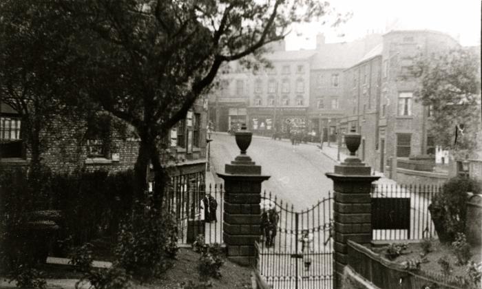
Church Street from back stairs of St. Mary's Church, Gateshead
Photographer: Unknown
Date: C.1925
Reference Number: GL002816
Looking towards Mr Oxley/Mr Booth Cycle
Dealers at 29-33 Bottle Bank. This photograph show Church Street looking
towards Bottle Bank from the gates of St. Mary's churchyard. This
photograph shows Church Street before the construction of the Tyne
Bridge. To the left of the photograph is pictured the original Church
Street entrance to St. Mary's Churchyard. To the left of the gates is
the entrance to Cannon Street which ran along the south side of St.
Mary's Church.
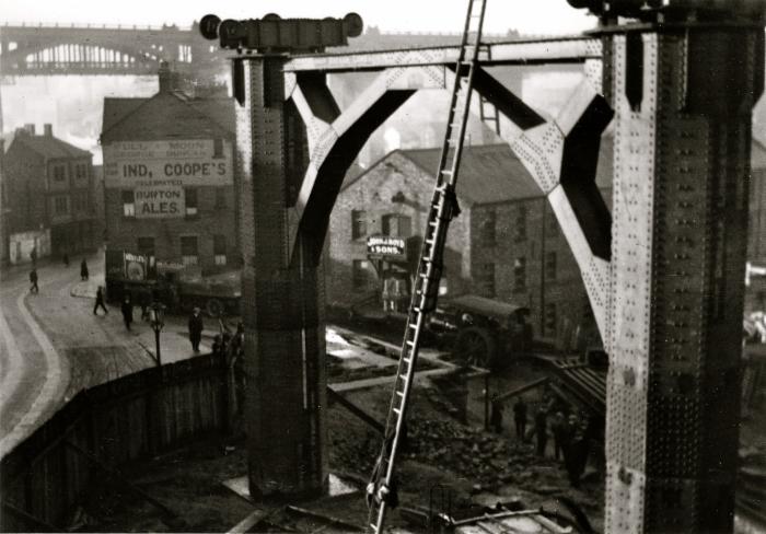
Tyne Bridge Construction, Gateshead
Date: C.1930
Reference Number: GL002825
This photograph shows Bottle Bank leading on to Church Street during the
construction of the Tyne Bridge, showing the Full Moon pub. Much of the street was demolished to make way
for the Tyne Bridge tower and approach roads in the 1920s.
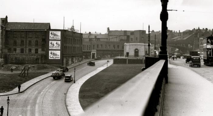
Church Street from Tyne Bridge, Gateshead
Photographer: Kell, G
Date: Date Unknown
Reference Number: GL002804
Item Description: This photograph shows Church Street looking
north towards Gateshead High Street from the Tyne Bridge. Originally
Church Street ran off Bridge Street in an arc past St. Mary's Churchyard
and led back onto Bottle Bank. It was not named until 1826 and for many
years was simply referred to as 'the New Street'. (Manders, 1973). Much
of the street, along with a section of St. Mary's churchyard was
demolished in the early 1920s to make way for the Tyne Bridge south
tower and approach roads. Note Snowball's Dept Store, in what was called Kent House which later was Shephard's when they had a fire in their Ellison Street store, which they moved back to, when the premises were rebuilt
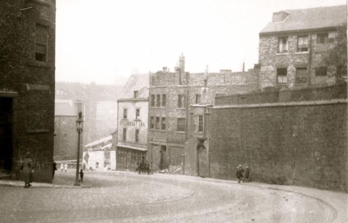 Church Street looking towards Bridge Street, Gateshead
Photographer: Unknown
Date: C.1925
Reference Number: GL002829
This photograph shows Church Street before the
construction of the Tyne Bridge. To the right of the photograph is
pictured the wall of St. Mary's Churchyard. This part of the
churchyard was removed along with the Steamboat Inn (pictured background
centre) and other buildings on this section of the street shortly after
the photograph was taken to make way for the Tyne Bridge tower and
approach roads.
Church Street/Church Walk brought to you by

The Felling Heritage Group